The UN General Assembly has overwhelmingly backed a resolution calling for the use of a world map that more accurately represents the size of Africa and other continents.
The “Correct the Map” resolution, sponsored by Togo and supported by African Union members, received 164 votes in favour, including from France and the UK. The United States was the only country to vote against the resolution, while six countries abstained.
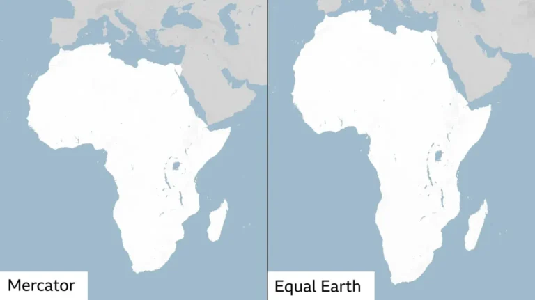
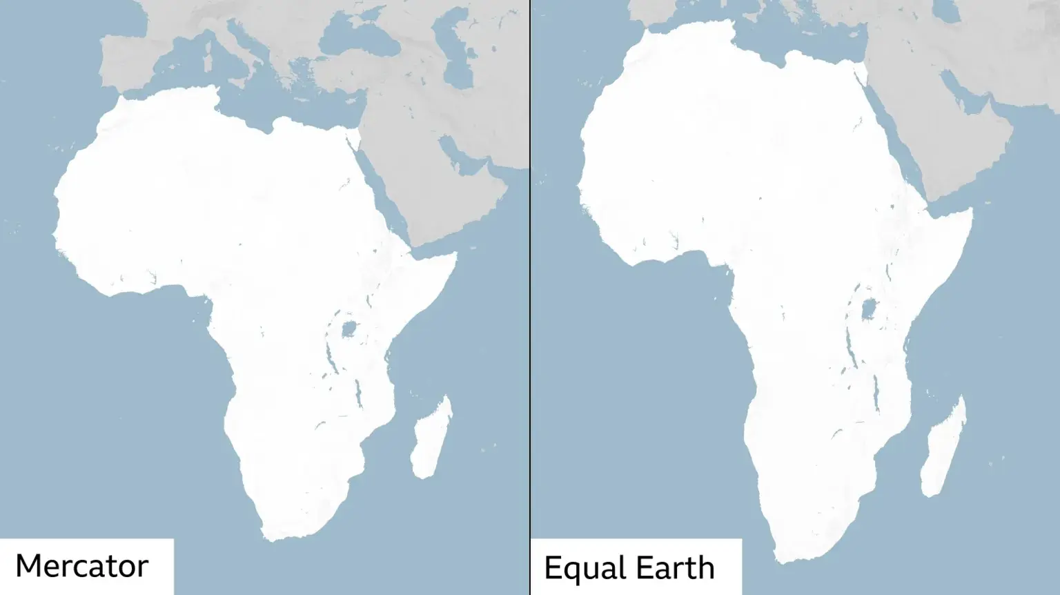
Although the resolution is non-binding, its adoption is expected to encourage institutions around the world to consider alternative map projections, including the Equal Earth projection, which presents the relative size of continents more accurately than the widely used Mercator map.
The Mercator projection, which has been widely used since the 16th Century, has long faced criticism because of the way it distorts the size of landmasses.
One of the most notable examples is Africa and Greenland. On a Mercator map, Greenland can appear roughly comparable in size to Africa, despite Africa being about 14 times larger.
Critics argue that such distortions can contribute to misconceptions about the geographical importance, development needs and potential of countries and regions closer to the equator.
The Mercator projection was developed in 1569 by Flemish cartographer Gerardus Mercator. It was designed primarily to help European navigators plot courses across the world’s oceans.
Its distortion is a consequence of trying to represent the curved surface of the Earth on a flat, two-dimensional map.
Why world maps distort the Earth
There is no way to create a completely accurate flat map of a spherical planet. Different map projections therefore make different compromises, distorting aspects such as size, shape, distance or direction.
The Mercator projection preserves directions and angles, making it particularly useful for navigation. However, it increasingly enlarges landmasses as they get closer to the North and South Poles.
As a result, countries and regions in northern and southern latitudes can appear significantly larger than they actually are, while areas around the equator appear relatively smaller.
The debate over the Mercator projection has led cartographers to develop alternative ways of representing the world.
Equal Earth projection
In 2018, a team of cartographers developed the Equal Earth projection, an equal-area map designed to represent the relative sizes of continents more accurately.
The projection was created by Tom Patterson, Bojan Šavrič and Bernhard Jenny as an alternative to maps that significantly distort the size of landmasses.
In February, the African Union’s 54 member states adopted the Equal Earth projection and said it “more accurately represents the sizes of all continents, particularly Africa”.
Supporters say the change could help provide a more realistic understanding of Africa’s geographical scale.
The online campaign group #CorrectTheMap has also promoted the use of more accurate maps, highlighting the enormous size of the African continent.
The group says the United States, China, India, Japan, Mexico and much of Europe could fit within Africa while still leaving land.